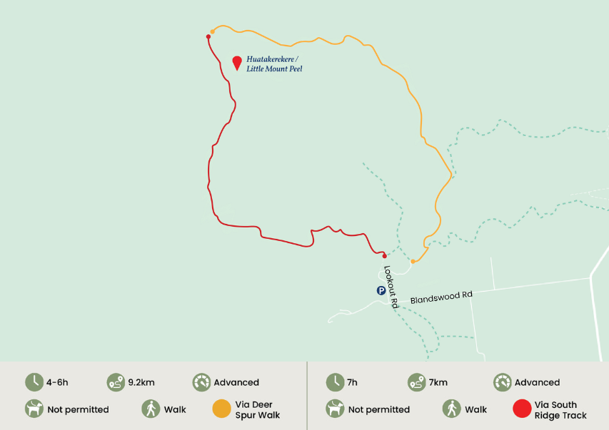
Little Mount Peel (Huatakerekere)
Track Description
Little Mount Peel/Huatekerekere
via Deer Spur Walk
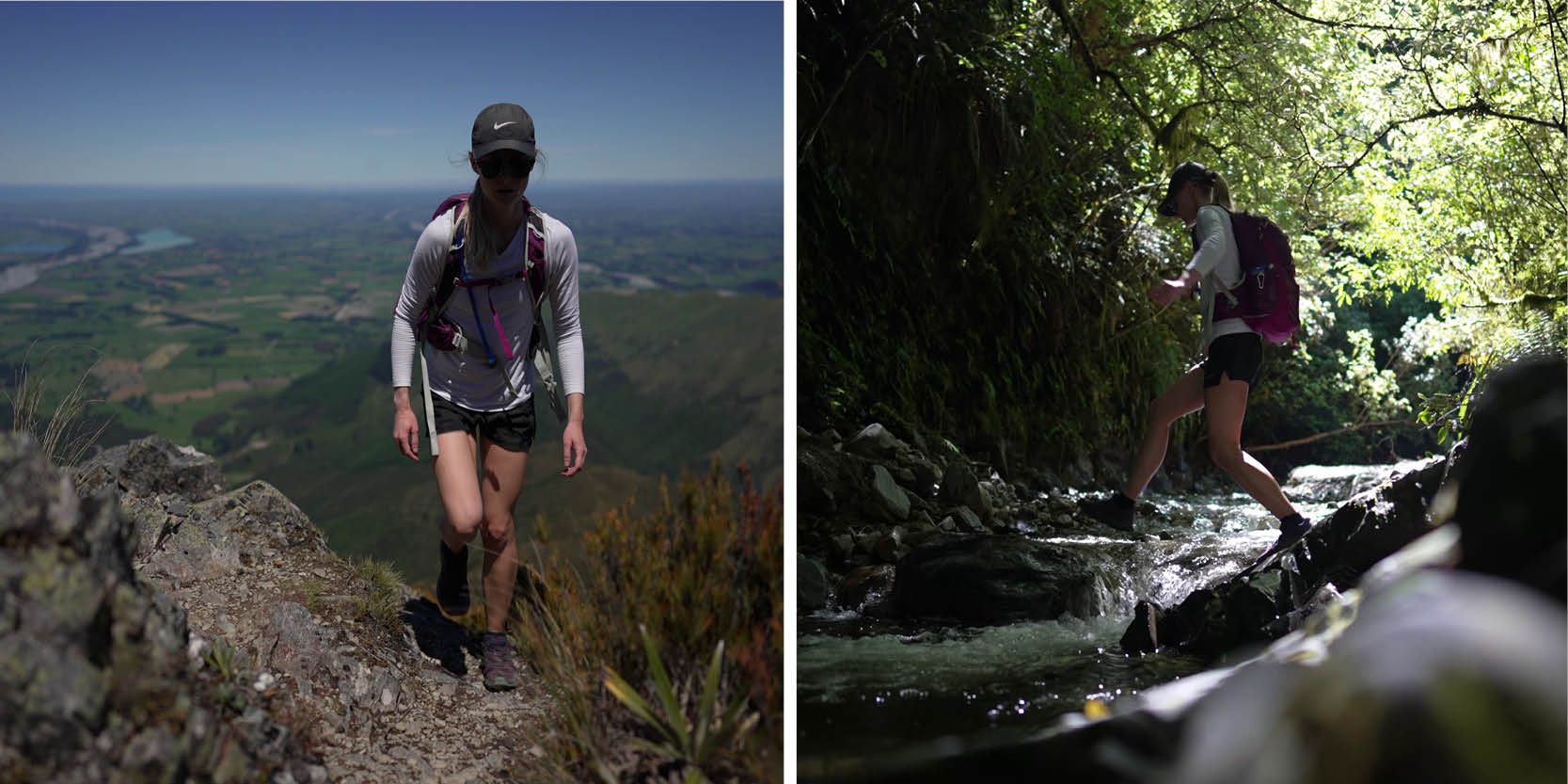
This is one of the most popular peaks in Canterbury. From the car park at Blandswood, walk up the steep Blandswood Lookout Road to the top. Follow Fern Walk for about 350 m before turning left on to Deer Spur Track. The track follows a ridge up to the summit (1311 m). There are magnificent views to Mt Somers, Mt Hutt and across the plains to the coast. Tristam Harper Memorial Shelter is just below the summit. Note: This is an alpine summit. Here the weather can be very different from at road level. Ensure you take appropriate clothing and equipment, and check the weather forecast.
Little Mount Peel/Huatekerekere
via South Ridge Track
An alternative to climbing or descending Little Mt Peel/Huatekerekere from Deer Spur is to use the South Ridge Track. The South Ridge is steep and involves a couple of rocky scrambles. South Ridge Track connects with Deer Spur at the top of the mountain and Emily Falls Track near the bottom. When descending from Little Mt Peel/Huatekerekere it is important to keep to the ridge until the track sign shows the route down a tussock-covered spur to the bushline and Emily Stream.
There are other tracks that cross private land which can be accessed via the public tracks within Peel Forest. Please see the Department of Conservation website doc.govt.nz for more details.
Getting There
From Geraldine town centre, take SH79 north out of town and over the Orari River Bridge. Keep left as you come off the bridge and follow along the Inland Route 72 for 3kms before turning left onto Peel Forest Road. Stay on Peel Forest for approximately 13 kilometres before turning left onto Blandswood Road. The walking tracks starts at the end of Blandswood Road.